Create a Visual Travelogue with Photo Mapo
 Need a really cool summer vacation app that can double as a pretty powerful instructional tool?
Then Photo Mapo is a must-have digital gem that has countless classroom app-lications. That’s right! This really swell resource can transform photos into mapped masterpieces that can be shared with family and friends across social media networks including Facebook, Twitter, Flickr and Instagram.
Here’s how Photo Mapo works: Choose one of 23 template styles (Postcard, Treasure, Retro, etc.) and tweak the background color. Then select a favorite photo from the camera roll and add an optional description to the image. Other information that can be customized on each “postcard” includes date, time, latitude, city, state and country. Map type (terrain, roads, hybrid and satellite) as well as Map Zoom (how much detail is displayed) can also be determined in the settings. Another super cool feature is that Photo Mapo has the GPS technology to attach the actual location where the picture was taken or the user can enter a specific address. The latter is a very cool option, especially when third party photos are being utilized (Flickr, Creative Commons and the like).
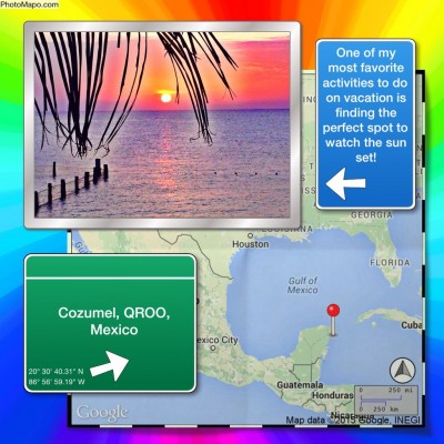
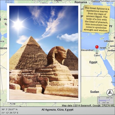
Check out a few samples shown below. Hopefully they’ll get those wheels turning!
For fun…
For the classroom…
Classroom Connection:
Do I even have enough space to share the ways Photo Mapo can be utilized in the classroom? Seriously, when I first saw this app, I immediately thought of the social studies angle: Historical figures, events, places and/or landmarks. But after giving it some additional thought, this cool tool has potential far beyond one content area—field trips, setting of a story or book, visual writing prompts or even the creation of graphics to accompany writing activities (favorite and/or bucket list destinations) and lit trips (similar to those created with Google Earth) to name a few. A Photo Mapo image could also be a nifty way to promote school or professional events—assemblies, conferences, trainings, workshops, etc.
As a creative twist, students can get busy with an app smashing project by doing the following: Create a mash-up of several photos utilizing the Pic Collage app and then import that image into a Photo Mapo to create a unique geographical masterpiece.